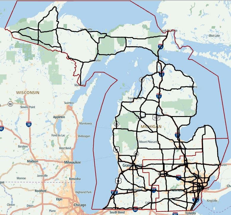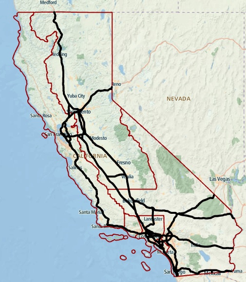
TomTom has announced the launch of their Highly Automated Driving (HAD) map products at CES 2016, meant for all interstate roads in California as well as all interstates and freeways in Michigan.
Of course, both California and Michigan are states that serve as testing grounds for driverless cars, which is why TomTom is presenting their HAD Map and RoadDNA products in those regions. With the HAD Map delivering a highly accurate and realistic 3D border-to-border model of the road, a vehicle will use that data and match it with the RoadDNA data in real time.
By doing so, the car will know its precise position at all time, even when traveling at high speeds or when changes occur to the surrounding environment.
TomTom CEO Harold Goddijn stated that he is proud of his company’s “extended HAD leadership demonstrated by delivering 25,000 kilometers of HAD maps for the United States, less than four months following the launch of our HAD Map for the Autobahn network in Germany,” before adding that “TomTom is more excited than ever about the prospect of partnering with members of the HAD ecosystem to expedite the innovation that will transform the automotive industry and the way we drive.”
If you’re interested to know exactly what the HAD Map coverage is, we can tell you that it’s currently working on all net2class 0 roads in California (12,000 km / 7,456 miles) and all net2class 0 and net2class 1 roads in Michigan (13,000 km / 8,077 miles).
PHOTO GALLERY