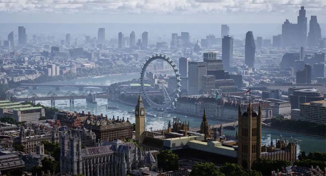
An intriguing new feature has been added to Google Maps to explore select cities as if you were a bird flying through the sky.
Dubbed Immersive View, the feature utilizes Google’s satellite images and its Street View shots to create a computer-generated 3D model of a location.
Read Also: Google Maps Disables Live Traffic Data In Ukraine To Protect Citizens
“We’re able to fuse those together so that we can actually understand, okay, these are the heights of the buildings,” one of Google’s VP of engineering, Liz Reid said. “How do we combine that with Street View? How do we combine it with aerial view to make something that feels much more like you were there?”
Google Maps’s new ‘Immersive View’ combines Street View with satellites: https://t.co/N99mv1RGCj pic.twitter.com/NtZ7Zd2mG8
— The Verge (@verge) May 11, 2022
Google says that Immersive View will work on just about any phone and device and will initially launch in Los Angeles, London, New York, San Francisco, and Tokyo. Additional cities are “coming soon,” the technology giant confirmed in a blog post.
“Looking for a spot for lunch? Glide down to street level to explore nearby restaurants and see helpful information, like live busyness and nearby traffic,” added Google Maps VP Miriam Daniel. “You can even look inside them to quickly get a feel for the vibe of the place before you book your reservation.”
Separately, Google Maps’ eco-friendly routing option has also been introduced in the United States and Canada. This mode of navigation allows users to select the most fuel-efficient route, helping them to save money on fuel and cut down on emissions. Google says the mode has already been used to travel 86 billion miles overseas and saved more than an estimated half a million metric tons of carbon emissions or the equivalent of taking 100,000 cars off the road.
Introducing an immersive view — a whole new way to explore on Google Maps. 🌎
You’ll be able to experience what a place looks and feels like before you arrive, powered by advances in AI that allow us to fuse together billions of Street View and aerial images. #GoogleIO pic.twitter.com/UCj7cInz2R
— Google Maps (@googlemaps) May 11, 2022